EL GEGANT DE LES TRES NACIONS

EDITORIAL ALPINA EL GEGANT DE LES TRES NACIONS

Books and Maps
Color N/A
  • N/A
Size UNI
  • UNI

  •  Click&Collect Click&Collect
    Available
  • Home delivery Home delivery
    Available
  • Free shipping from 120€ (EU) Free shipping from 120€ (EU)
  • 100% secure payment 100% secure payment
 

Hiking Map EL GEGANT DE LES TRES NACIONS Unisex


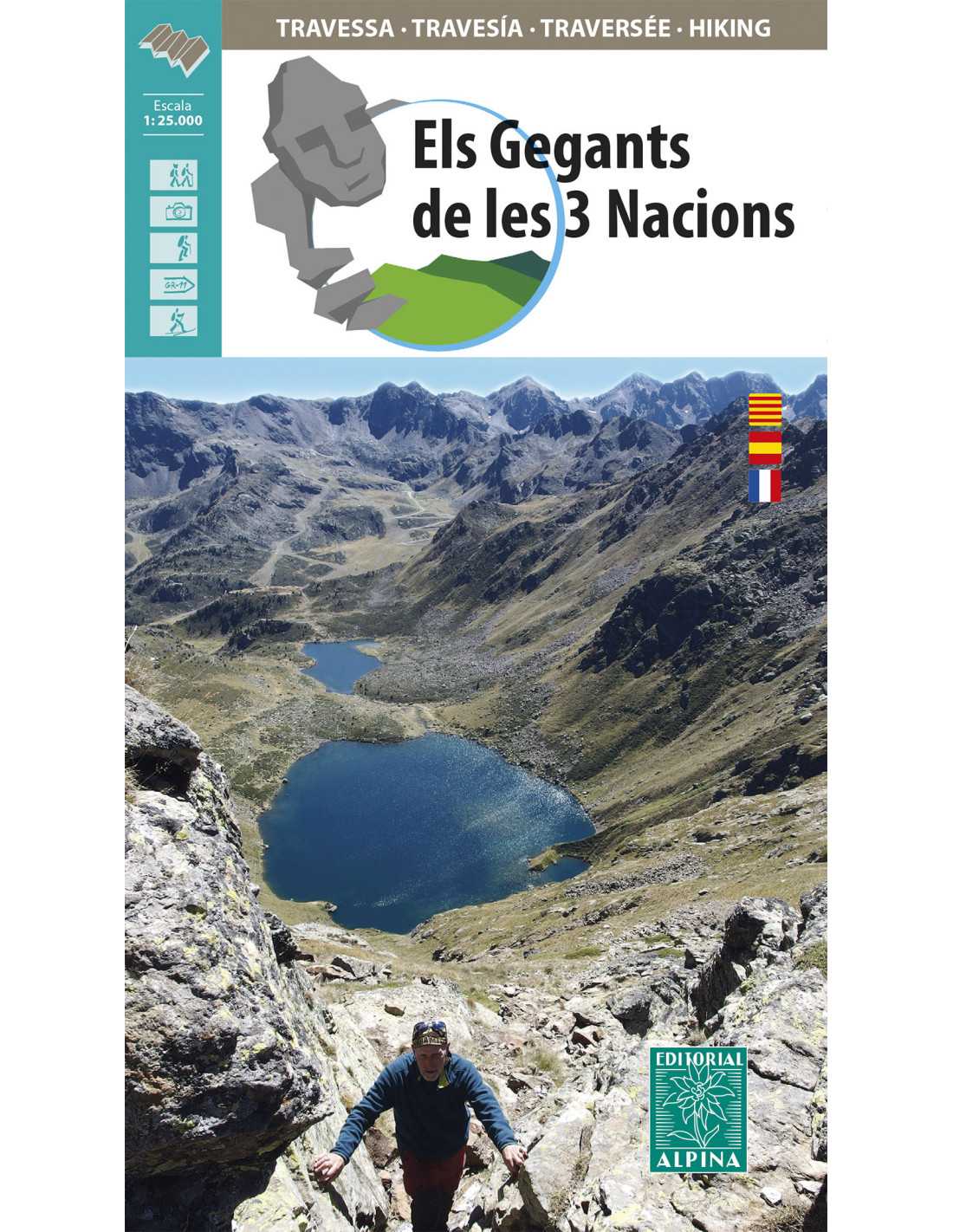
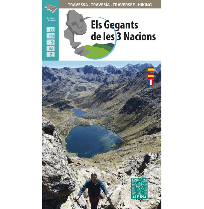
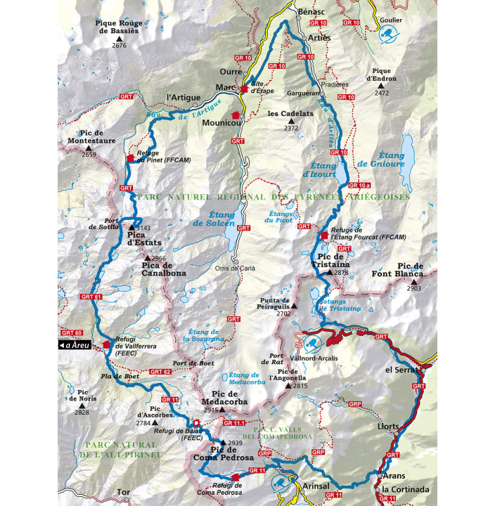
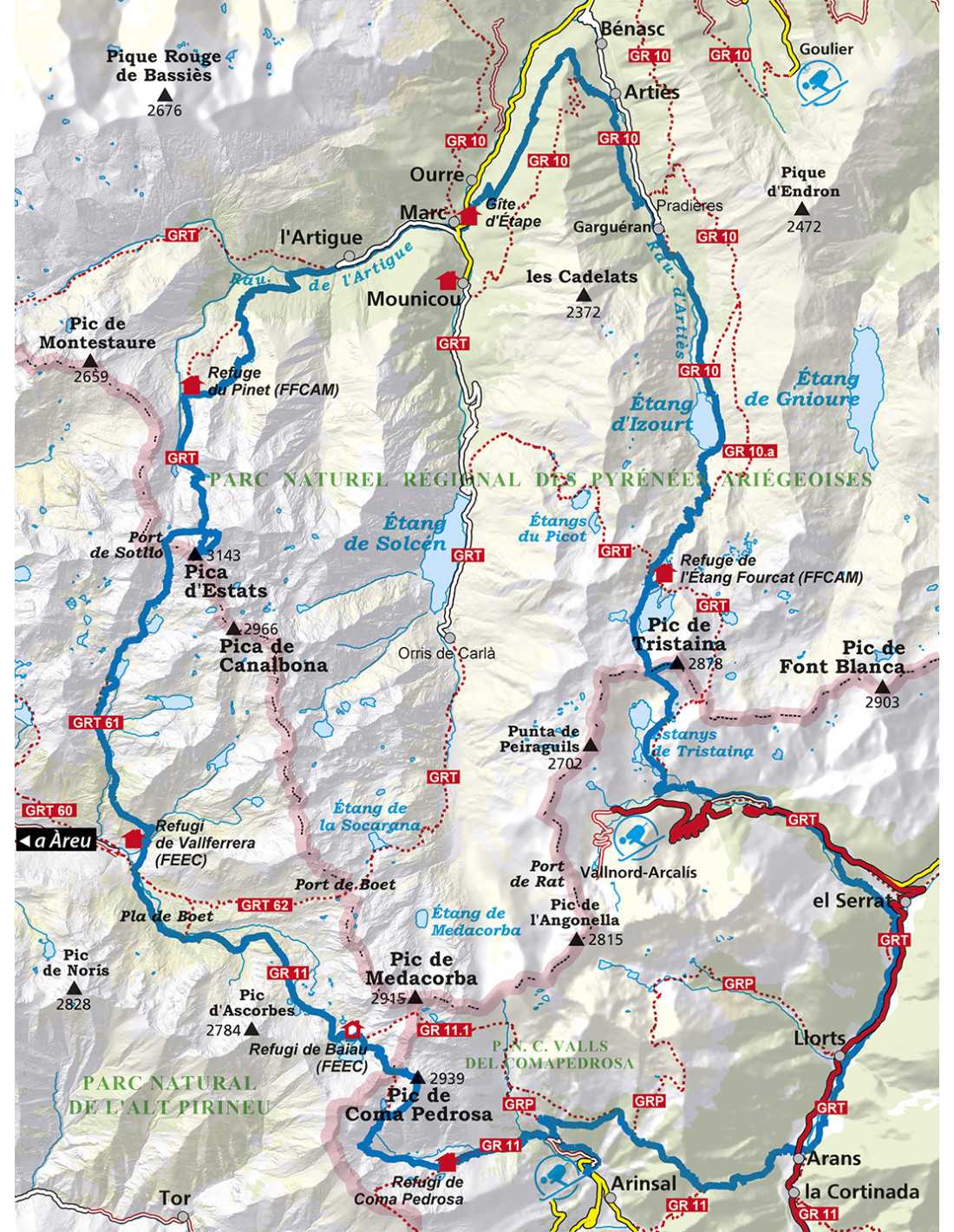
Explore the impressive Pyrenean Park of the Three Nations with this detailed hiking map. With a scale of 1:25,000, this map is the perfect tool to plan your route through some of the most impressive peaks in the region, such as La Pica d'Estats, the highest point in Catalonia and Ariège, and the Coma Pedrosa Peak, the highest peak in Andorra. You can also reach the magnificent Tristaina Peak or the Medacorba Peak, located at the intersection of Catalonia, Andorra, and France. This map covers three natural parks: the Alt Pirineu Park, the Coma Pedrosa Communal Park, and the Pyrenees Ariégeoises Regional Nature Park.


Product Details

  • Scale: 1:25,000
  • Edition: 2021/2022
  • Route Duration: 4 to 6 days
  • Regions Covered: Catalonia, Andorra, France
  • Highlighted Peaks: La Pica d'Estats, Coma Pedrosa Peak, Tristaina Peak, Medacorba Peak

Features

  • Includes detailed routes
  • GPS compatible
  • Water-resistant
  • Updated trail information
  • Altitude indications
  • Coverage of three natural parks
  • Guides to points of interest
  • Refuge signage
  • Description of flora and fauna
  • Hiking safety tips
Type of product
Books and Maps
Activities
Trekking
Genders
Man
Unisex
Women
Classification
Book and Map
EDIAL.9788480908832.X.UNI
9788480908832
BAA79D7DA23081E9DEAF793D5DDD3402
No reviews

16 other products in the same category:

You may also be interested

Product added to wishlist